
Travelling recently on a train from Camberwell to Richmond and returning, I had the opportunity to see our suburb from a different perspective – Hawthorn’s backside, so to speak; the grottier, less manicured and more eccentric views of our buildings, streets, parks and lanes. It was intriguing to see which parts of our suburb’s history are still visible in 2021 and which parts have been lost to us. Come join me as we explore Hawthorn’s History by Train.
The Hawthorn or Hawthorne Village as it was once known, was gazetted in 1852 and was the first village across the Yarra River, to the east of Melbourne. Situated in the Parish of Boroondara, meaning place of shade, it was a always a significant part of the land belonging to the Wurundjeri clan. However, not long after white settlement in 1835, the area soon came to the attention of squatters, farmers and woodcutters, who were keen to claim possession as well as supply produce and timber for Melbourne. This impost led tragically within a few short years ito the exclusion of the traditional people from their land, from access to the river, their food sources and the destruction of their lifestyle.
The movement of white settlers into Hawthorn, just like the traditional owners, was also greatly influenced by its flora and fauna, its hills and valleys and by proximity to the Yarra River and its tributaries. These water courses were important water supplies for both humans and stock and were essential for the early Hawthorn industries of brick making and tanneries as well as being necessary for the productive market gardens which flourished on the lower lying land well into the early 20th century. However, the rivers and creeks were also a barrier to growth in some areas because frequent flooding destroyed punts and bridges and worsened the condition of the roads, which became water logged in winter and potholed and dusty in summer. Travel was slow and tiresome.

So, it was the development of a reliable transport system – the train, first to Hawthorn station on 13th April 1861 and then to Glenferrie in 1882, that was the impetus for the rapid growth and spread of urban Hawthorn. For the first time families could live a healthier life in leafy, picturesque Hawthorn, whilst the bread winner could commute to Melbourne for work and return in the evening. If you didn’t wish to walk home and you had the money, then you could make use of the horse-cabs located in Evansdale Road to ferry you home for tea. Later still a horse-drawn tram also operated along the No.75 tram route, which at first terminated at Auburn Road.
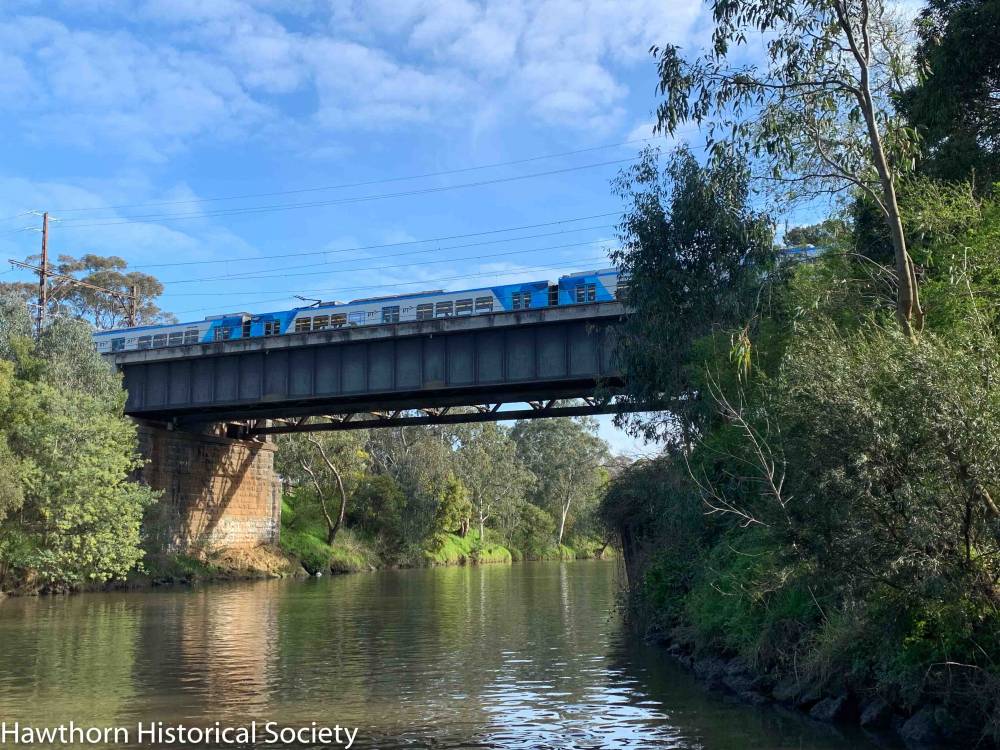
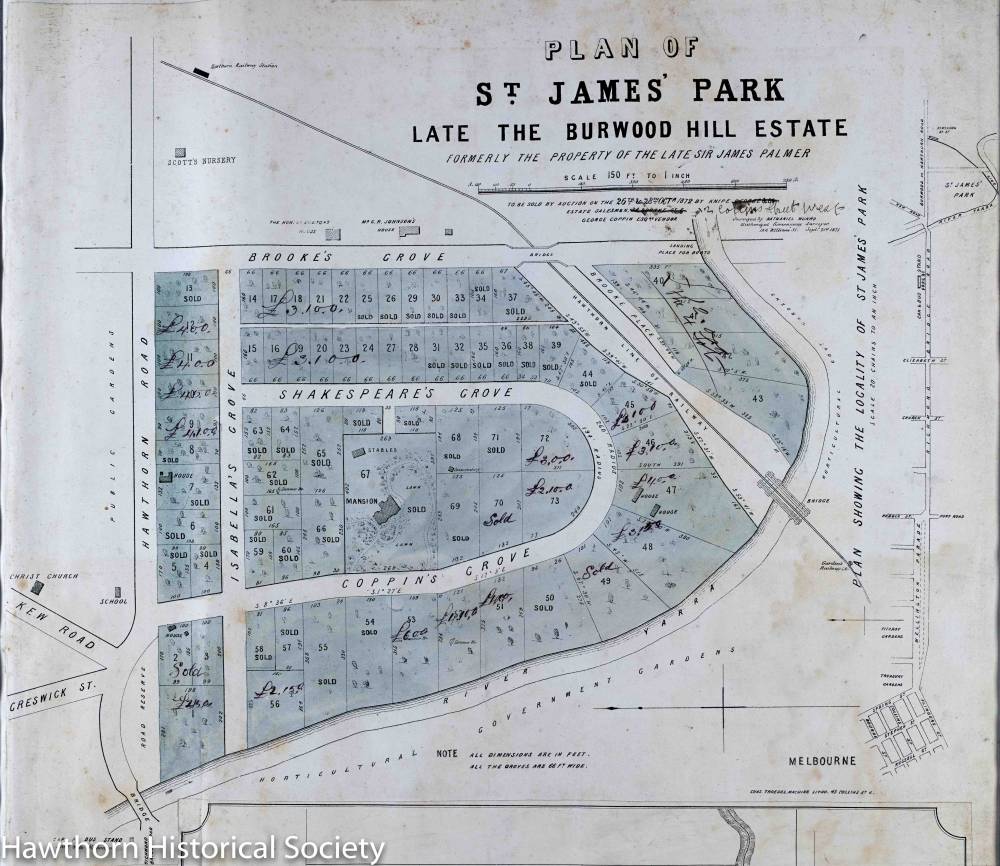
After crossing the river, our train slices through the southern section of the land which once belonged to two early purchasers from the 1840s of Crown Allotments in Hawthorn. Sir James Palmer and Thomas Power Esq. Both were important men in the new colony and also within the emerging Hawthorn community. The subdivision of their estates following their deaths includes the prestigious houses and large gardens in Coppin and Isabella Groves and Yarra Street. Travellers looking from the train windows on the northside, can see these leafy gardens and even a small vineyard that slopes to the river. A premium was paid for land situated on the elevated sites, like these within Hawthorn, which offered “clean air’ and wonderful views.This area known as the St James Park estate became Hawthorn’s first heritage protected precinct.
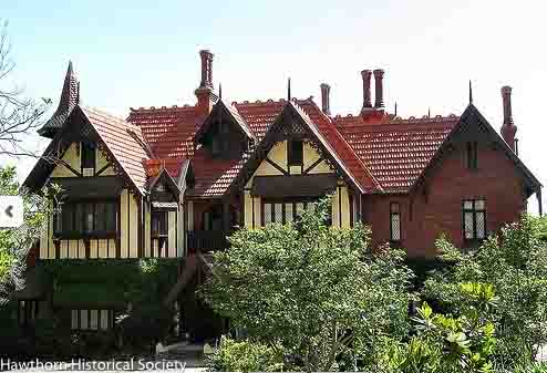
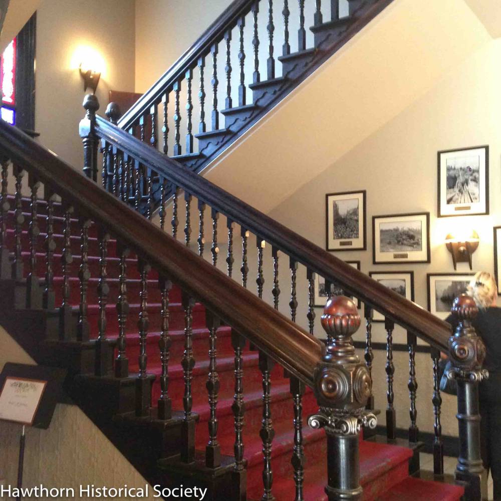
The train almost disappears through a cutting as we approach Hawthorn Station but on the southern side you can just see a few chimney pots of an amazingly eccentric house, Tay Creggan. Situated at the end of Yarra Street on land sloping steeply to the river, it was built by the young architect Guy Purchas, for his own use. Unfortunately, it was incomplete when he ran into money troubles during the 1890s bank crash. It is now occupied by the Yr 9 campus of Strathcona Baptist Girls Grammar School but perhaps in another blog we can explore some of the fascinating stories pertaining to its history: as a private house, whose flamboyant owners hosted regular garden parties, musical and dance soirees, as well as charity fundraising events and fetes. Later still, it was owned by the Catholic Church and used by the sisters of The Grail, as an education centre and hostel for up to 50 young Catholic women. Strathcona purchased the building in 1969 and has carried out extensive restoration and renovations.
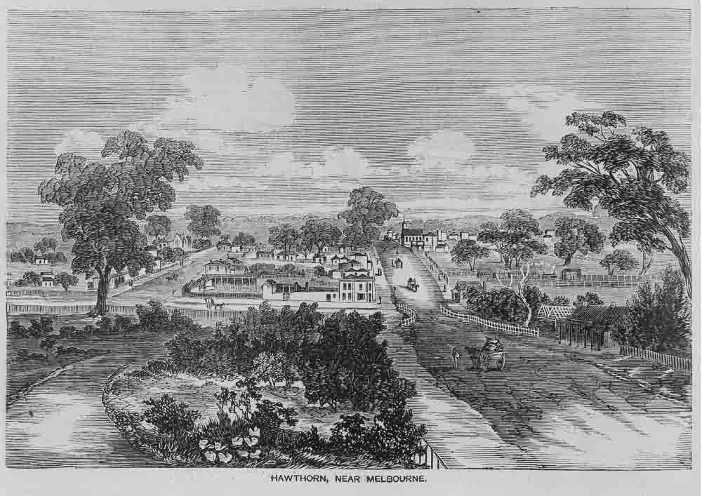
The first incarnation of the Hawthorn Railway station in the early 1860s was a very simple affair, as shown by this engraving from 1863. Note the Hawthorn Village Common to the left, now the well established St James Park; also the poor road surface of the main thoroughfare, now Burwood Road; the small bridge over Connell’s creek at Barton Street; the first Hawthorne Hotel on its corner, this later became the Whitehorse Hotel; and the single platform train station on the right, next to James Scott’s Royal Nursery. Low patronage at first threatened the viability of the train line, but the Municipal Council persuaded, then owners and operators, Melbourne and Suburban Railway Company, to reduce the fare and build a shelter offering protection from the weather, at one end of the single platform. Patronage improved and of course over time so did the infrastructure, including the addition of more tracks and an island platform using a canopy from the original Flinders Street Station. The weatherboard clad station which was in a dilapidated state by the 1980s was given a $300,000 restoration in 1986 and is now heritage listed. However, for twenty years Hawthorn station was the railway terminus for the eastern suburbs.
The State Government took over the railway network in 1878 and in the 1880s a strip of land parallel to Burwood Road was purchased from the estate of Michael Lynch of Grace Park. The extension of the railway line to Camberwell and beyond in 1882 necessitated the first in a succession of adjustments to accommodate the overall geography of the area and allow traffic to flow on existing north-south cross-roads. Tunnelling was required under Burwood Road and Power Street but grade separation between the railway tracks and Glenferrie Road, John, Henry and William Streets did not eventuate until after 1916 when the rail line was elevated. This helped the steam trains negotiate the steeper gradient up to Camberwell Station.


The first steam train on this extended line was on December 1st 1882, and with all the dignitaries on board it was a grand occasion. All stations on the line were decorated with red, white and blue bunting, bands played and children waved flags.
As our train approaches Glenferrie we see glimpses of the trees in Grace Park, a lower lying part of the once much larger Lynch estate and beside the train track I spy the individual plots in the very popular Community Garden. Then finally the Glenferrie Oval, the spiritual home of the Hawthorn Football Club comes into view.
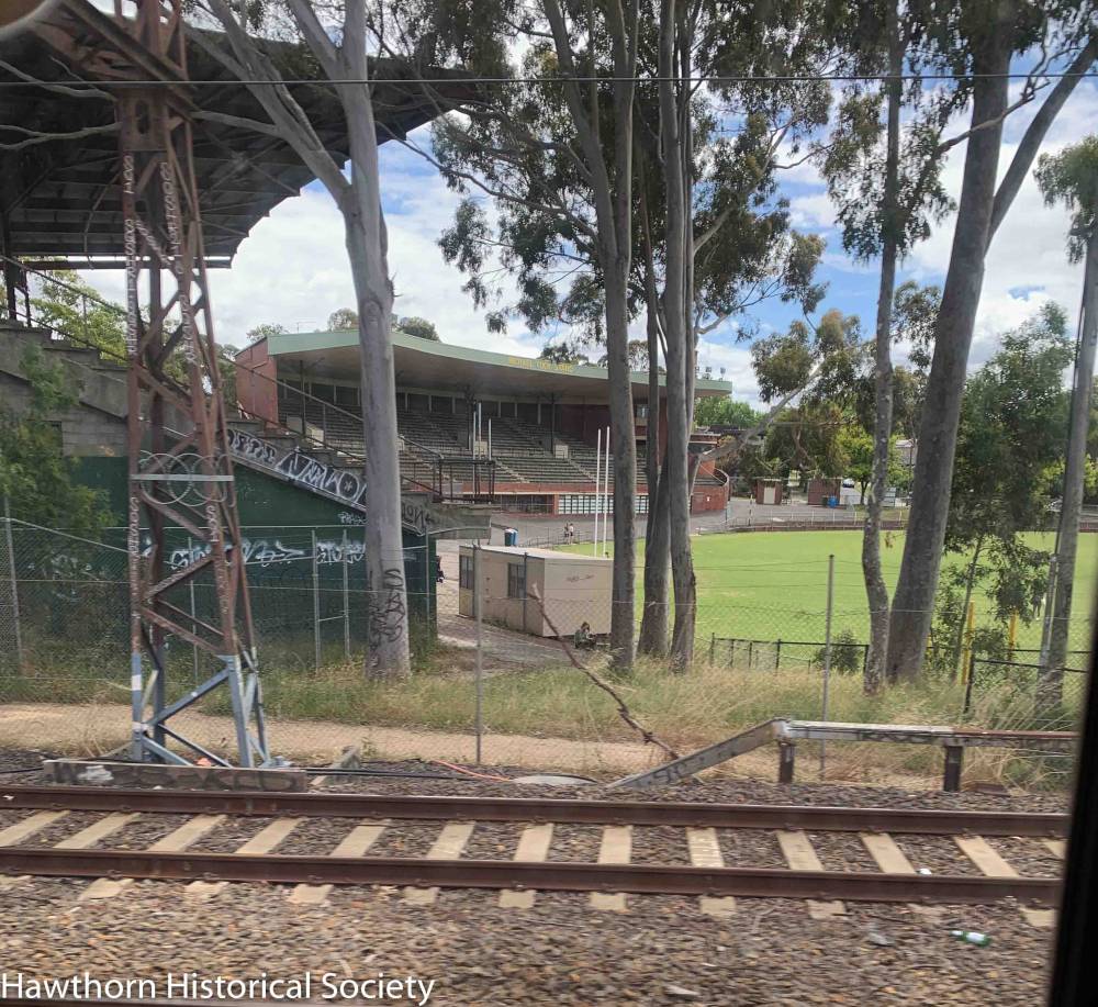
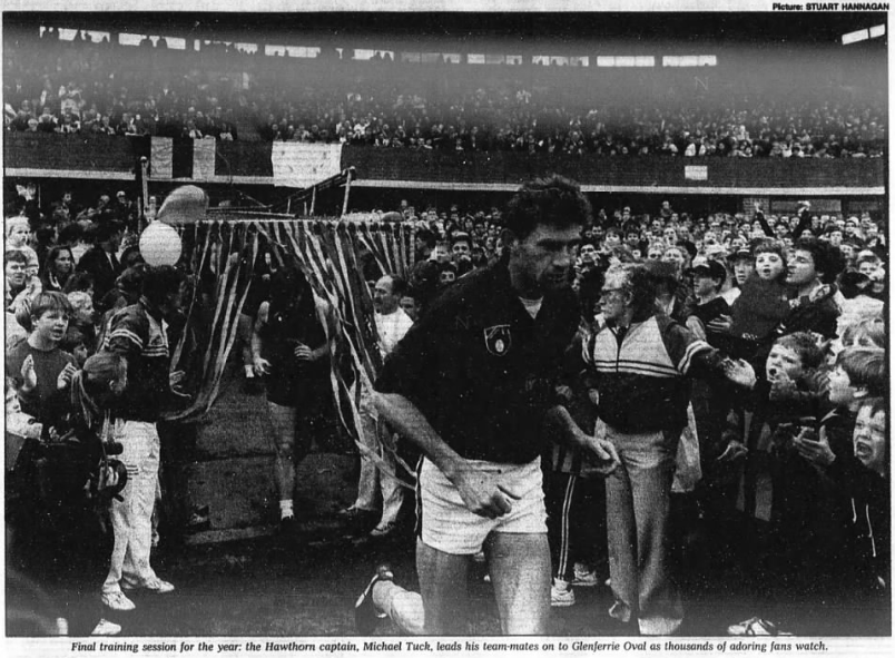
A Hawthorn football club was born in February 1873 after 20 potential members turned up at the local Hawthorne Hotel (opposite the Hawthorn Station) and within a few weeks the team had played their first scratch match wearing blue knickerbockers with light blue and white stripe guernsey. Over the years the team played on various paddocks, St James Park, Grace Park and Meaney’s paddock on Barkers Road, changed their stripes and suffered many losses, amalgamations and resurgences before making the Hawthorn Sports ground (now called Glenferrie oval) its home ground. The team joined the VFL in 1925 and the main grand stand was built in 1937 but was later named after Hawthorn football great, Michael Tuck. The team now wearing brown and gold played their last game here in 1973, but the club, retained its training, administration and social club on site until 2006. Although the club has now moved on, the community camaraderie it generated is still firmly etched in the psyche of those who grew up barracking for Hawthorn. However, we are still waiting to see what plans the Boroondara Council have for the restoration of this heritage listed stand which has remained unoccupied since the Club left over 15 years ago.
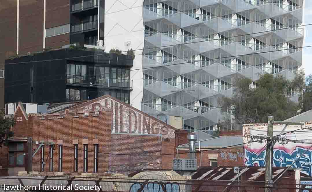
Today from this high vantage point one can see the faded ghost signs advertising long-gone businesses and the branding of the Dixon buildings from 1922. Below it is Tin Pan Alley, the scene of the robbery of local Commercial Bank manager Mr Charles Berriman in 1923.
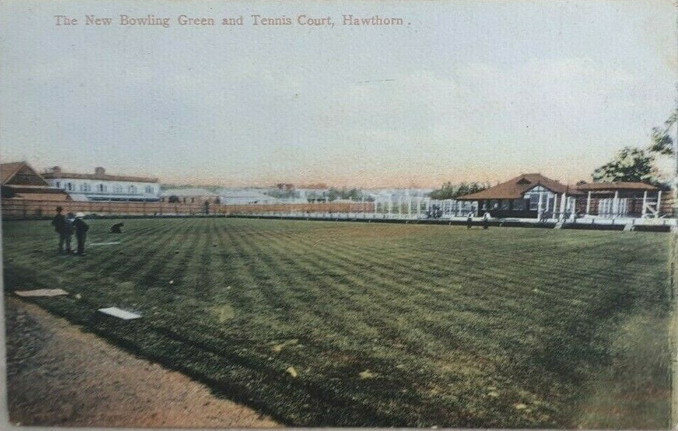
And then the train passes beside the new Hawthorn Aquatic and Leisure Centre which has replaced the once new Hawthorn Recreation Centre from the 1980s and long before that the old swimming pool, bowling greens, croquet courts and tennis courts from 1905.
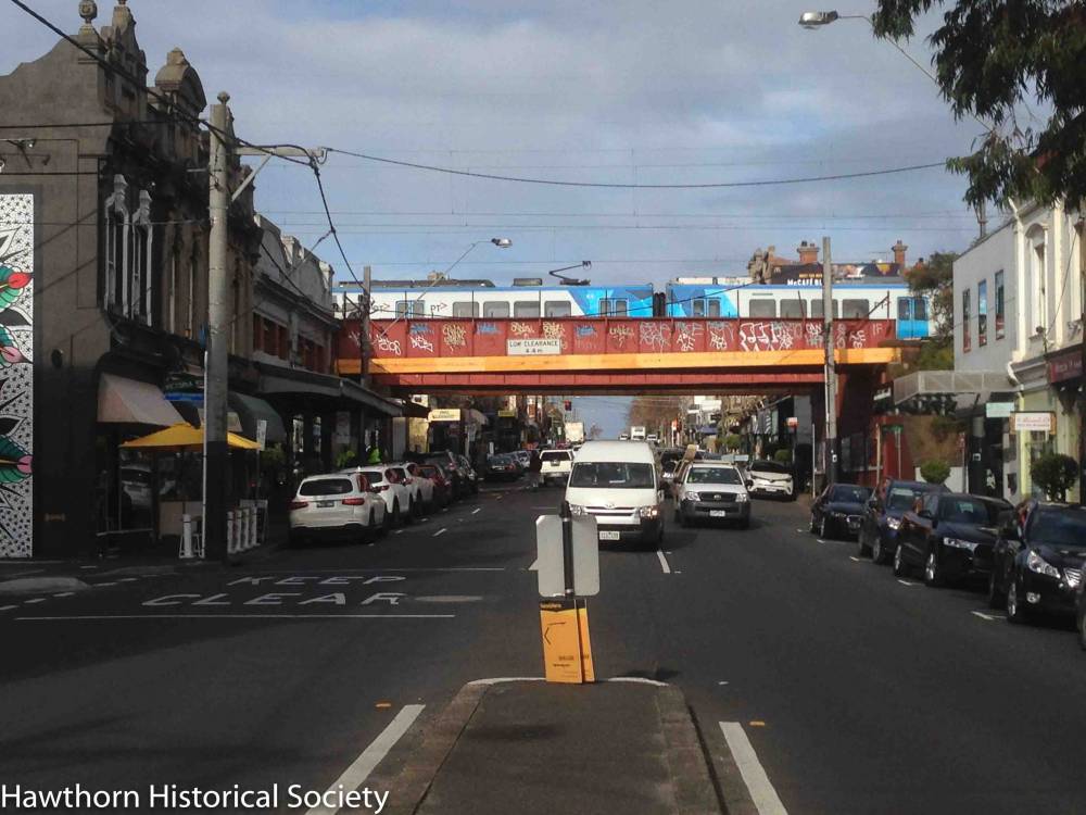
As we cross Glenferrie Road, looking south I notice the spire of Immaculate Conception Church, built from the winning design of Crouch and Wilson architects. This distinctive gothic style Catholic church was commenced in 1868 on land donated by Michael Lynch, but it wasn’t complete until 1921 when the transept and spire were added and now the beautiful church occupies a spot on the most prominent intersection in Hawthorn and the church spire can be seen for kilometres from all directions. Sitting on the diagonally opposite corner is the Hawthorn Town Hall, now repurposed as Hawthorn Arts Centre.

Surprisingly as the train pulls into Glenferrie Station you find yourself at roof top level with the buildings on Glenferrie Road and adjacent to the decorative parapet on the building on the northern side which was once the Don’s Cash Store.

The Don Store was the highly successful, first department store for the eastern suburbs. The large building contained several specialty departments, workshop areas and had an extensive mail order business operating from the buildings at the rear very close to the parcel despatch at the Glenferrie station. This greatly assisted the Don Store in its quest to supply mail-order customers from all over Australia.
It was first established by businessman and councillor, Charles Bethune in 1910, and it opened to enormous fanfare and the enthusiastic crowds flooding the streets required police supervision. Some might say it was a precursor of the Boxing Day sales in the city.
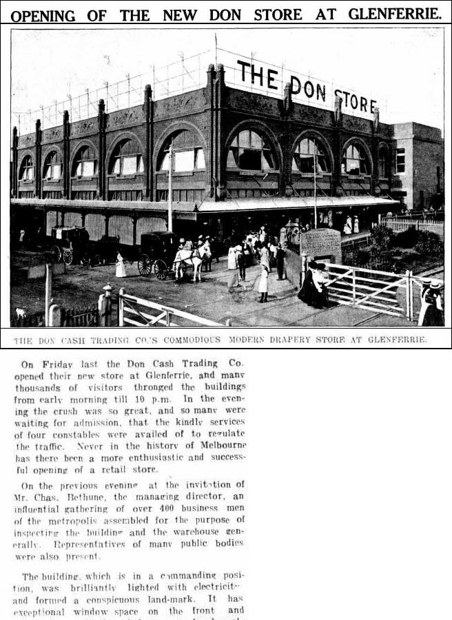
After a change of ownership the store traded as Snows in 1915 and then later as Walkers. The site has since seen many further retail changes, a fresh food market, supermarket, specialty shops and even a dance studio and nightclub on the upper levels.
By early 1883 there were now 31 steam trains daily along the newly constructed route. The opportunities for land subdivision and property speculation through the Glenferrie, Auburn and East Hawthorn and Camberwell areas was enormous. Not surprisingly, by the late 1880s, the Glenferrie shopping strip had begun to over shadow the earlier shops and businesses on Burwood Road which until then had been clustered around the Hawthorn station. With the expansion of housing subdivisions in the east the population also grew rapidly. Hawthorn was declared a Town in March 1887, necessitating of course the new and impressive Town Hall, designed by John Beswicke, which opened in 1889 and by the next year, Hawthorn was proclaimed a City.
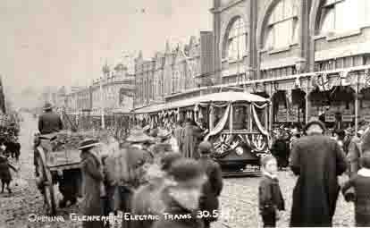
Glenferrie Road’s popularity as a retail and entertainment precinct was cemented by the arrival
of the Glenferrie Road electrified tram which connected Kew to St Kilda in 1913. Well supplied
with picture theatres like the Glen Theatre, the Palace, confectioners and dance studios like Silks
and Zeigfields, Friday night shopping and socialising on Glenferrie Road became hugely popular
during the first half of the 20th Century. Today at street level the mix of businesses on
Glenferrie Road has changed, perhaps not so many butchers, bakers, fruiterers, grocers,
bootmakers, watchmakers and dairy outlets. Many of these small business operators have now
been replaced by cafes, takeaway food outlets and supermarkets but others like Paterson Shoes,
did survive for decades.
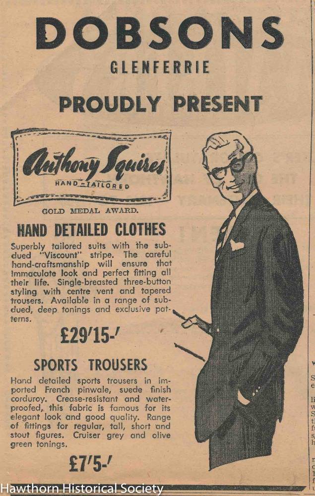
Dobsons Clothing Store (1918) and Lawrencia Cycles (1938) continue to thrive. Even the
Glenferrie Theatre building now houses specialty shops and has come full circle with the Lido
picture theatre complex and its roof top cinema.

I was travelling during a period when the Covid pandemic left many businesses struggling and
schools and universities closed or forced to provide online study. There was a definite reluctance
to travel on public transport so the carriage was almost empty and I was not restricted in my
movements from one side of the train to other. In fact, the absence of hustle and bustle and in
particular, the lack of Swinburne University students joining or leaving the train at Glenferrie
Station, certainly made the stop at Glenferrie station feel quite strange.

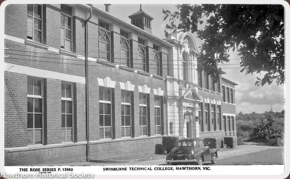
The train then passes one of the Swinburne University’s many buildings. The university now
occupies large tracts of real estate stretching almost from Glenferrie Road to William Street and
from the railway line to Burwood Road. Its success and expansion has had an enormous
influence on the growth of the suburb. It started life humbly in 1908 as the Eastern Suburbs
Technical College and was later named after its major supporter and fundraiser, the engineer
George Swinburne. Swinburne was a philanthropist, a Hawthorn councillor and mayor, who
lived in Kinkora Road and represented the electorate of Hawthorn in the Victorian Legislative
Assembly, where he was influential as Minister for Agriculture and Minister for Water Supply.
It is interesting to note that, even a hundred years before the present State government’s push to
eliminate railway crossings and ease traffic congestion, the rail track between Glenferrie and
Auburn stations had already been elevated. As we cross over the north-south cross streets of
John, Henry and William Streets, it is certainly hard to conceive the inconvenience to both
residents and commuters, of the train line at ground level. Men, often assisted by their wives and
families, were employed to open and close the railway crossing gates to allow the trains to travel
through. Numerous stories featured in the local newspapers of the time, highlighting both the
inherent risks these men and women faced, as well titillating the reader with stories of horses
with their carts still attached, bolting down the tracks, potentially towards an on-coming train or
with trains in hot pursuit. The elevation of the track must have been a blessing for all.
So, as we travel on towards Auburn Station and sitting from the comfort of my near empty
carriage, I had a bird’s eye view to the north of some of the less noticed parts of the suburb. I
caught glimpses of the backyards of little weatherboard cottages which may look much as they
did in the 1920s, as well as areas of green parkland which in most cases were created after their
earlier lives as clay pits. The numerous claypits around Hawthorn were responsible for the production of the famouse Hawthorn bricks.
Gardens, or “Rocket Park”(once a claypit) on the right.
John Street is no longer a throughfare, having been absorbed into the heart of the University, but the renovated and extended houses in the other cross streets are now in high demand, as they are so convenient to the Glenferrie shops, public transport, the Central Gardens and good public and private schools.
Swinburne Image bank has a number of images of these cross streets from earlier times when they were occupied by numerous working-class families.

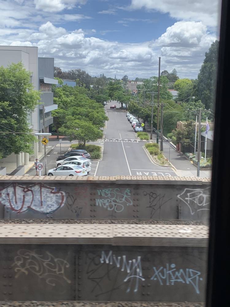
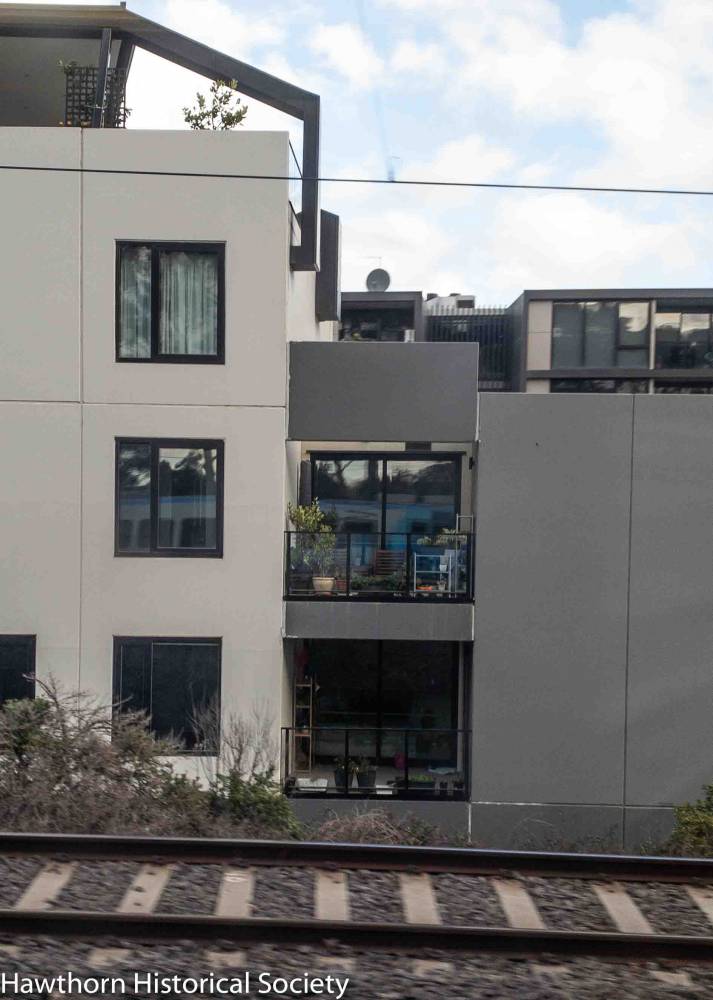
Of course, “close to transport” has been a popular real-estate ‘catch cry’ for many years and this has never been a truer statement as a result of the recent State Government push for higher density housing along main thoroughfares. Now if one looks to the south, to the land between the railway line and Burwood Road, there are scores of new apartment buildings. Unfortunately, being close to transport also obliges many of the residents in these apartments, to let me see at close range how they go about their daily lives and observe how they utilize their limited personal pace.
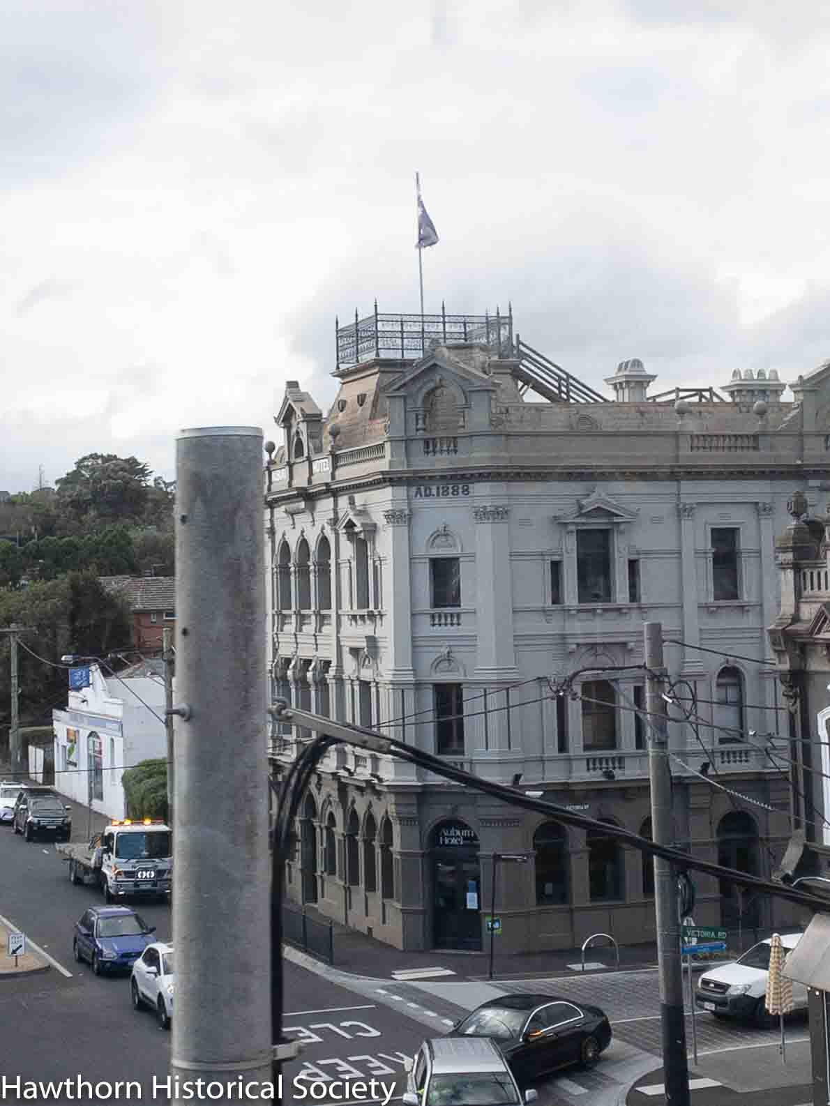
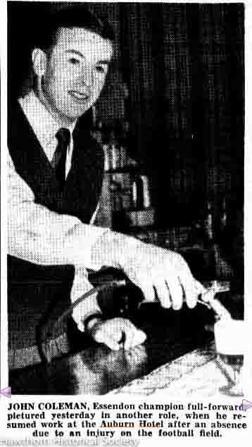
The Auburn Hotel comes into view as we cross over busy Auburn Road. This imposing building of three storeys with its flagpole was built in 1888 at a cost of £7280, on land belonging to Mr Allen, an early Hawthorn resident. The hotel hasn’t changed very much since that time. In 1948 it was owned by AFL legend John Coleman along with licensee Ted Rippon and for a long time in the late 1980s, it was known as the Geebung Hotel, but in recent years it has reverted to its original name.
Auburn Station also retains its old-worldly charm as does the whole of the Auburn Village heritage precinct, with a pleasing grouping of village type shops housed within the distinctive architectural style of the 1880s, much of which was designed by John Beswicke. Beswicke, who designed the Hawthorn Town Hall, was familiar with the area as he lived further up the hill towards Barkers Road, in prestigious Harcourt Street. He and other prominent Auburn citizens on the hill had panoramic views from their two storey villas.
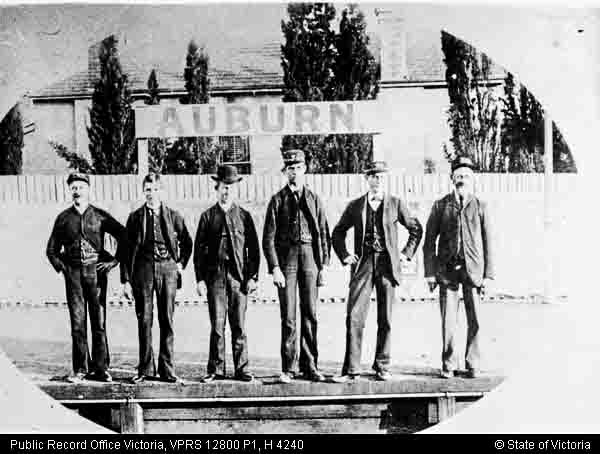
In this image, taken around 1908, before the line was elevated. We can see numerous horse cabs clustered around the dip in Auburn Road near the station and the prominent streetlighting located in the middle of the Burwood and Auburn Road intesection Most of these buildings remain although several have now lost their verandahs.


As we sweep along the stretch from Auburn station to Camberwell Station, we pass many smaller timber cottages and then come to Liydale Grove, Newport Crescent and Auburn Grove where all the houses line up on the street facing the trainline.

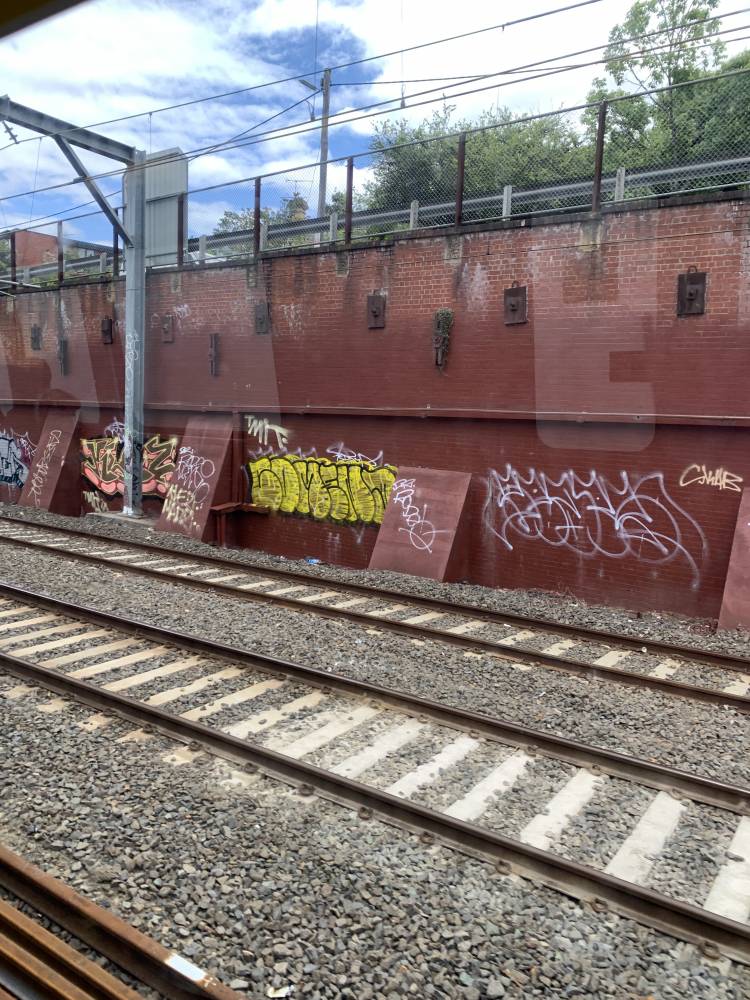
The train eventually passes through a graffitied cutting and before long we emerge at the Camberwell Station on Burke Road. This was once the boundary between the two suburbs; Hawthorn on the western side and Camberwell claiming the eastern side. Now since the amalgamation of the two cities along with the City of Kew, to form the City of Boroondara in 1994, this distinction is no longer necessary and to avoid confusion, the buildings on the west now take the Camberwell postal address.
So it may be only a short 5 kms train trip from the Yarra River at Richmond to Camberwell station but there is a lot to see and so much history to reflect upon when you investigate Hawthorn’s History by Train.
Eliabeth Love, December 2021